Maps
Preferred Concept
This page's exhibits include a preliminary concepts map, preferred concept map, and an interactive map. View the exhibits or interactive map in greater detail by clicking on the images.
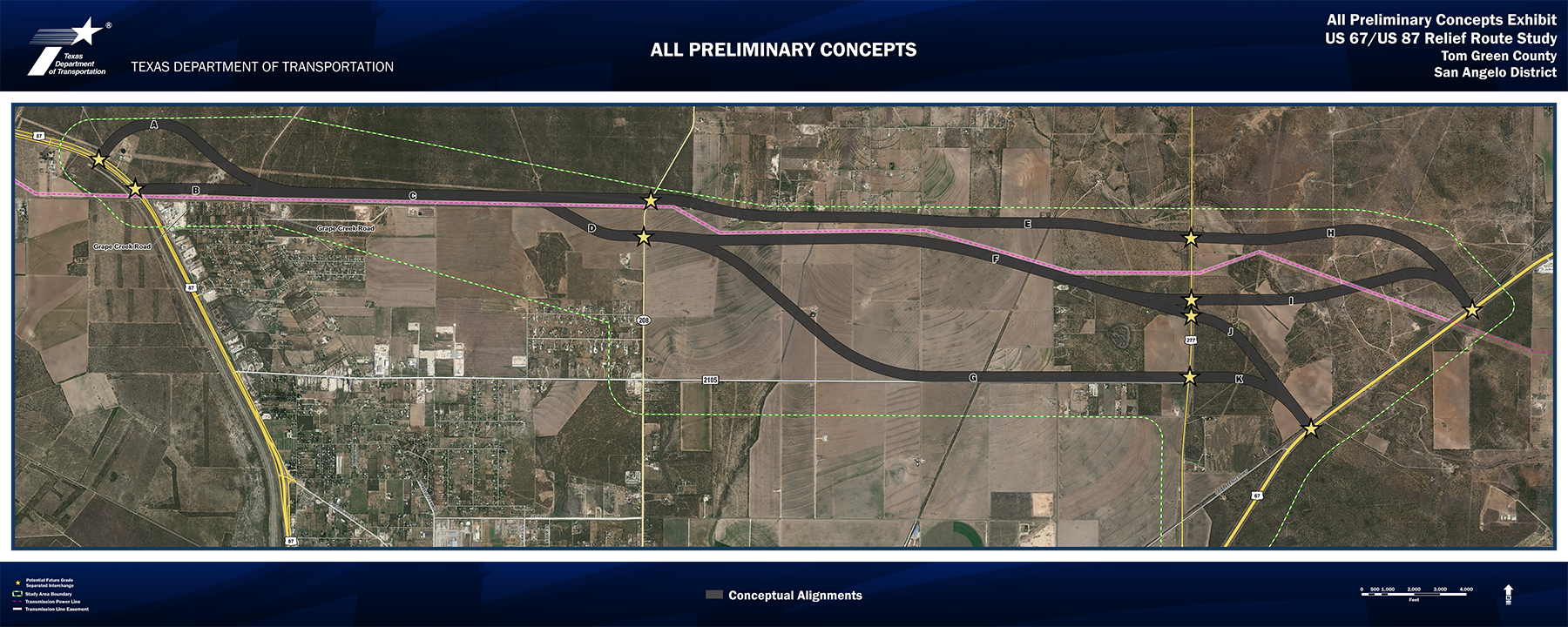
Preliminary Concepts

Preferred Concept
(B-C-D-F-J, Maroon)
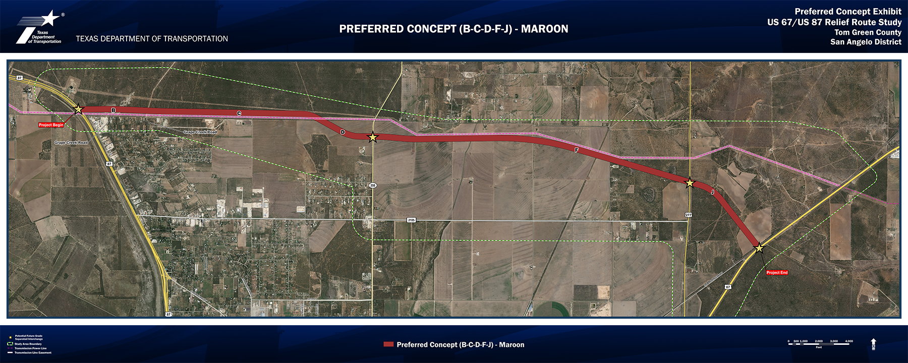

After applying the Phase II Screening Matrix to the Advancing Concepts, TxDOT decided to choose Preliminary Concept 8 (B-C-D-F-J, Maroon) as the Preferred Concept. TxDOT determined this concept best met the project Purpose and Need, the Phase I and II Screening criteria, and was the most technically preferred concept. The Concept 8 (Maroon) would have the lowest right-of-way and construction costs, is among the shortest distance of the concepts, has the second lowest impacts to parks of the concepts, and potentially only impacts one business.
The Maroon Concept starts at US 87 and ties in adjacent to the north side of the transmission powerline easement. It continues east along the north side of the powerline easement crossing over west of SH 208 prior to grade separating. It continues east along the south side of the transmission powerline easement and grade separates over US 277, then travels south to meet US 67 at a perpendicular angle immediately north of the Old Ballinger Highway intersection. The Maroon Concept is 9.03 miles long.
Interactive Map
The interactive project map is easy to use on your computer or device and allows you to zoom in and out, pan around, and identify features on the map. Use the map options to enhance your viewing.

 View the map legend
 Change the map background
 Print a copy of the map
Measure distances between points
 Add a comment to the map
+/- to zoom in and out
Type in an address to find a specific location